

CartoDB is an open-source, cloud-based data mapping platform to store and map geographic datasets. You need a dataset file with a geographic column – coordinates and polygons – load it into CartoDB account and play with the visualisation interface to generate a map. A series of wizards can be used to create simple or category maps (displaying markers or regions coloured on the basis of explicit categories), bubble maps (markers aggregated in clusters), choropleth maps (regions coloured with a colour-scale based on a numeric variable) and torque maps (maps that show events over time). Locations such as cities can be geolocated inside CartoDB by running a geolocation process on the geographic column, but keep in mind that only a limited number of geolocalizations are free of charge.

it allows to create basic maps very quickly with no coding skills.
the limits of the free plan that allow the storage of up to 5 tables (max. 5 Mb in total) and 10,000 map views per month. Three different paid plans are possible and offer more features, larger web space and 24 hours support – their prices range from $29 per month to $7,999 per year.
Moderate
Yes
Drag and drop your dataset in the CartoDB dashboard and start playing with the data. If you have a geographic column with cities or regions, you can geolocate it by running a georeference process (just click on the column's header). Once your data is uploaded and geolocated you can click on visualise, play with the wizards, configure the legends and choose the design to customize your map. Finally, you can copy and paste the embed code to include your new interactive map on your website or blog.
CSV, XLS, GEOJson, SQL, KML, ESRI Shapefile.
Interactive map (embed code).
The data is stored on the cloud so we would suggest you to strip all the sensitive information (such as name, surnames or IP addresses) from the dataset before uploading it.
CartoDB itself is an Open Source project (under a BSD license) and it make use of many different Open Source projects. However, some of the services it is based on or libraries it uses are released under different licenses.
- German 2013 election map application published by sueddeutsche.de.
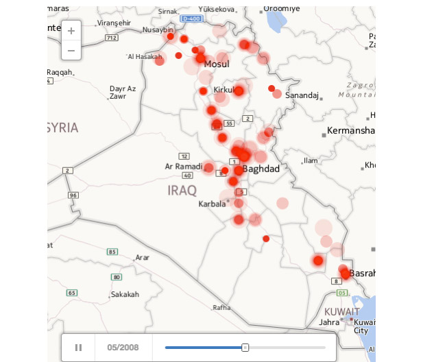
- Time-based map of the Iraq war casualties published by Foreign Policy.
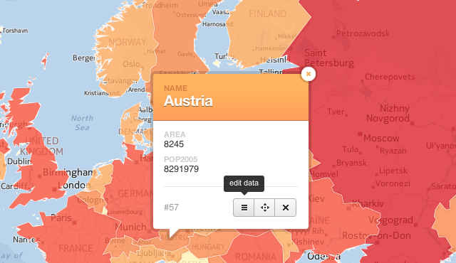
- Check the CartoDB gallery to see some case studies.
You can read the documentation, follow their tutorials and attend a course in their map academy.