


QGIS – previously known as Quantum GIS – is a free and open-source desktop application that allows you to create, edit, visualise, analyse and publish geospatial information.
It is a complete GIS software. It includes all the features that spatial professionals, geographers and general users would expect. For example, with QGIS it is possible to import data from multiple sources, digitising, editing, on the fly reprojection, data analysis, geoprocessing, database connectivity and raster processing.
If you want to get your hands dirty with maps and cartography, QGIS is definitely a software to try out.
It's extremely powerful and with it you can make everything you want related to cartography and maps.
Cartography is a science and it could be easy to create misleading maps, as well explained in the book How to lie with maps by Mark Monmonier.
Steep
No, you can install QGIS on your machine and use it offline from your desktop.
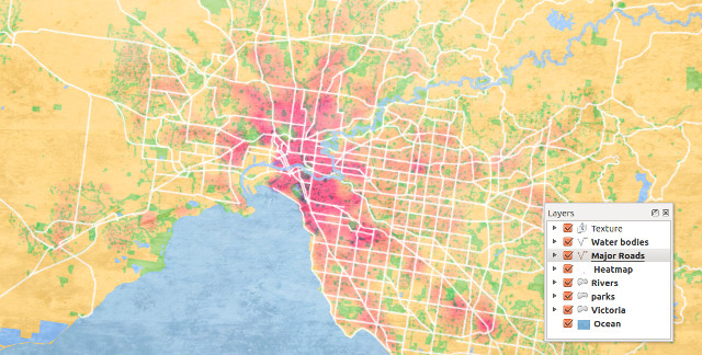
To get your hands dirty you can open QGis and start playing with its interface. You might want to create a map. To do so, you can follow this nice tutorial by Ujaval Gandhi. As explained on his tutorial, you can start by downloading and extracting the Natural Earth Quick Start Kit data, open it in QGis and start playing with the map's layers.
You can easily import CSV and spreadsheets on QGIS. To do it you can follow this handy step-by-step guide.
You can save your maps in JPG or PNG and print them or you can create interactive maps combining QGIS and Leaflet – a popular open-source Javascript library for building web mapping applications – and publish them online.
Not necessarily, just watch for private data you could visualise on your map.
QGIS is free software and is developed by the QGIS Development Team.
QGIS is released under the GNU Public License (GPL) Version 2. Developing QGIS under this license means that you can (if you want to) inspect and modify the source code.
- 20+ tutorials on QGIS
- 5 video tutorial on QGIS, from the interface to vector data
- How to work with terrain data